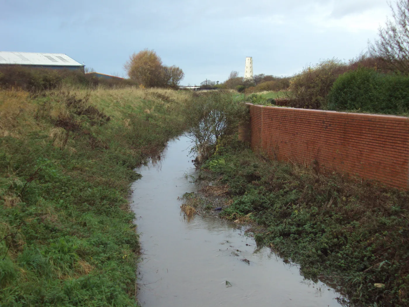

Machines are in at Hoylake Carrs. Fifteen scrapes and a low bund will hold 45,000 cubic metres of floodwater above Meols, and the site stays closed to walkers.
Work has started on turning 24 hectares of grazing marsh near Meols back into wetland. The site is Hoylake Carrs, part of New Hall Farm in west Wirral. Crews are reconnecting a canalised stretch of the River Birket with its floodplain, and the council says the landscaping runs through the summer months. (Wirral Council, Wirral View, 12 August 2026)
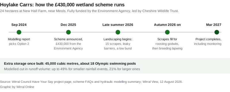
The scheme costs £430,000 and is fully funded by the Environment Agency through its Natural Flood Management Programme. Cheshire Wildlife Trust is leading it, in partnership with Wirral Council, which owns the land. (Wirral Council, Hoylake Carrs Natural Flood Management)
What is actually being built
The council’s own project documents set out three types of feature:
- Scrapes, shallow dips in the ground that fill with water. Fifteen of them are planned.
- Leaky barriers, structures that slow the flow rather than block it.
- Bunds, low raised banks that hold water back.
Together they are designed to hold extra water on the site during heavy rain. The project page puts that figure at 45,000 cubic metres; the scheme’s FAQ document puts it at up to 46,000. Both describe it as roughly 18 Olympic swimming pools. (Wirral Council, Hoylake Carrs FAQs)
There are no fixed barriers, so water still enters and leaves through the usual channels. The council states plainly that local flood risk will not be increased and that the extra surface water stays within the site.
The number that justifies it
The design was chosen on modelling, not on hope. A hydraulic modelling report dated September 2024 tested two options for the site using HEC-RAS software.
Option 1 was scrapes and leaky barriers. Option 2 added a shallow bund. Both cut the volume of water running off the site, and Option 2 cut it further:
- up to 49% reduction for smaller rainfall events
- 21% reduction for larger events
Option 2 is the design being built. The report also identifies what actually causes flooding here: runoff down the hillslope, and backflow from Newton Brook. The wider Birket catchment covers about 36.2 square kilometres of mixed farmland and town. (Wirral Council, Hydraulic Modelling Report summary)
The place this is meant to protect is downstream. Meols sits below the site and can flood from the river and from the sea, a combination the Environment Agency expects to worsen as the climate changes.
Birds are the other half of the job
The timing of the work is set by birds. Scrapes dug this summer should fill in the autumn, in time for migratory waders such as black-tailed godwit that roost here through late autumn and winter. If the water holds into spring, the council expects lapwing to breed on the site.
Hoylake Carrs is designated Coastal and Floodplain Grazing Marsh, a priority habitat. It sits close to the Dee and Mersey estuaries, which hold internationally important numbers of wetland birds. More than 90% of the UK’s wetland habitat has been lost in the last century, according to the Joint Nature Conservation Committee figure the council cites.
The design followed the river’s own history. LiDAR mapping revealed palaeochannels, the traces of where the Birket used to run, and the new features follow them.
Jack Helsby, the Senior Living Landscape Officer leading the project, said it was about “letting water slow down, spread out and sit where it wants to, rather than moving it on as quickly as possible”.
Councillor Ann Ainsworth, vice chair of the council’s Environment, Climate Emergency and Transport Committee, called it “a great example of the practical action we’re taking in Wirral to address the climate and nature emergencies”.
What it means for you
If you live in Meols or downstream of the Birket. This is a flood scheme first. It will not stop a serious flood on its own, and the council does not claim it will. What the modelling says is that less water will arrive in the river at once. Nothing about your flood insurance or your property’s official flood risk rating changes because of this work.
If you were planning to go and look at it. You cannot. The fields at Hoylake Carrs have no authorised public access now and will not have any once the work is finished. The public right of way along the western edge, known locally as Tip Lane, and the one along the northern edge are both unchanged. Walk those and you will see the site, not enter it. For places you can actually get into, see our things to do in Wirral page.
If you want it to look different. The council and Cheshire Wildlife Trust are running an ideas board on the project page and taking questions at biodiversity@wirral.gov.uk. Comments are being considered on a rolling basis rather than to a closing date.
If you want to help. Cheshire Wildlife Trust intends to set up a local volunteer network for the long-term management of the site, and there will be volunteering on the species monitoring. Neither is open yet. The Trust says it will publish the opportunities through the project’s Have Your Say page when they are.
If you farm or walk near it. The land stays in agricultural use. Seasonal grazing continues and parts of the site stay under hay management. The FAQ says the site will keep much of its present appearance, with visible standing water year round in the scrapes that sit below the water table.
The dates
Works are scheduled for late summer 2026, timed in consultation with Natural England for better ground conditions and to avoid the core passage and wintering period for protected bird species. The project runs to March 2027, which covers the establishment of the new features and the monitoring arrangements that follow.
Roadworks and closures across the peninsula are on our Wirral roadworks and travel page, and planning decisions are tracked on our Wirral planning news page.
Sources
- Wirral Council, Wirral View: Work begins at Hoylake Carrs wetlands, 12 August 2026
- Wirral Council, Have Your Say: Hoylake Carrs Natural Flood Management
- Wirral Council, Hoylake Carrs Natural Flood Management FAQs (PDF)
- Wirral Council, Hydraulic Modelling Report September 2024, summary (PDF)
- Cheshire Wildlife Trust, Wetland restoration project will benefit wildlife and local communities alike, 18 December 2025
Have your say